

E-walk - Offline hiking app for iPhone and iPad
Developer: Tim AUTIN
First release : 18 Mar 2017
App size: 59.59 Mb
E-WALK
E-walk allows you to download offline maps, to plan your treks, to show and share your position, to record your treks, etc... This makes E-walk the perfect companion for outdoors activities (such as trekking, hiking, biking, fishing, hunting, etc...) and for traveling abroad, because you can fully use it offline.
Lost in a forest? E-walk brings you back to your car. Forgot about where was this lovely boutique you noticed last year in Venice? E-walk refreshes your memory!
E-WALK KEY FEATURES
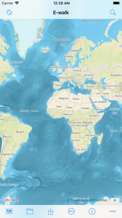
• worldwide high resolution topographic map (E-walk Topo Map), designed for hiking and outdoors activities
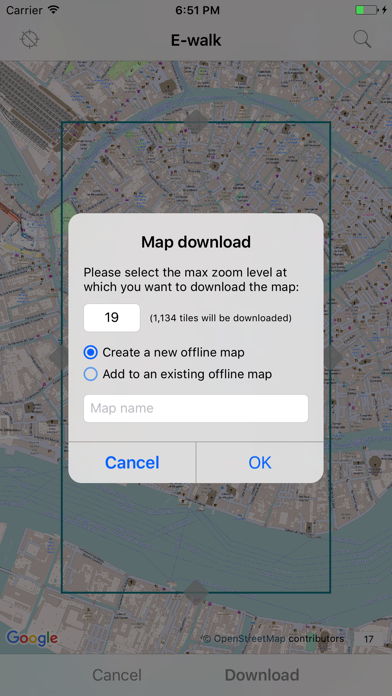
• download maps for later offline use (free for OpenStreetMap and Wikimedia Maps, with subscription for E-walk Topo Map)
• show your current location on the map
• search places (last searches are saved for offline use)
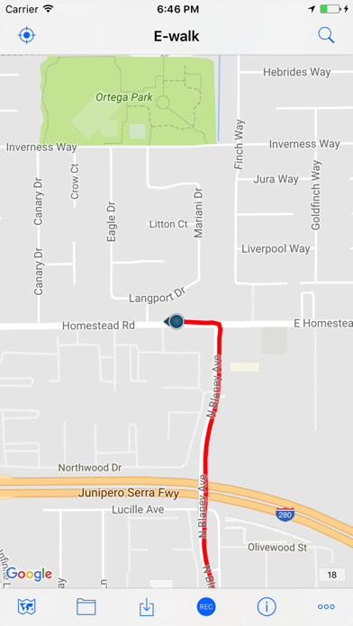
• record your treks
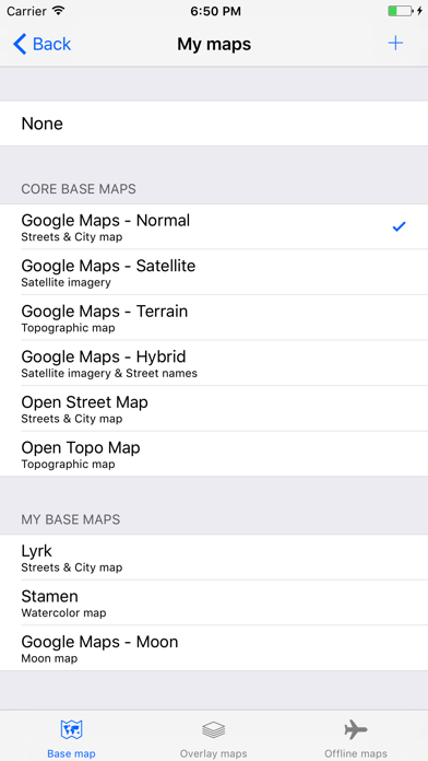
• select different base maps (streets, satellite, terrain, etc...)
• plan your treks by creating and editing KML files on the map. A KML file can contains markers, lines & polygons
E-WALK ADVANCED FEATURES
• organize your treks in folders & subfolders
• display overlay maps (weather, roads, metro/bus, ski slopes, sea map, etc...)
• share your position via e-mail or SMS
• open a position in your other geo apps (such as Google Maps and Apple Plans)
• share a trek by e-mail, bluetooth, etc...
• add custom maps in the XYZ protocol (see http://wiki.openstreetmap.org/wiki/Slippy_map_tilenames)
E-WALK PLUS
If you dont want ads, you can buy E-walk Plus in the store to remove them.
E-WALK MAX
If you want to download E-walk Topo Map to use it offline, you need to take the E-walk Max subscription. As long as it is active, it also includes all the benefits of E-walk Plus.
IGN PLUGIN (for France)
The IGN plugin adds several maps from the french national geographical institute (IGN), that you can browse online for free, and download for offline use if you subscribe to the Adventure licence.
It also allows you to use IGNrando (https://ignrando.fr/fr/parcours) for free. This is a service proposing tens of thousands of hiking routes in France. These routes can be downloaded to your device for offline use.
CONTACT
A problem with E-walk? A suggestion? A feedback? Please do not hesitate to send an e-mail to [email protected]!
IN APP SUBSCRIPTIONS
• E-walk Max: allows you to download E-walk Topo Map to your device for an offline use
• IGN plugin - Adventure licence (monthly or annually): allows you to view & download the french IGN (National Geographic Institute) maps
ABOUT IN APP SUBSCRIPTIONS
• Payment will be charged to iTunes Account at confirmation of purchase
• Subscription automatically renews unless auto-renew is turned off at least 24-hours before the end of the current period
• Account will be charged for renewal within 24-hours prior to the end of the current period, and identify the cost of the renewal
• Subscriptions may be managed by the user and auto-renewal may be turned off by going to the users Account Settings after purchase
• Any unused portion of a free trial period, if offered, will be forfeited when the user purchases a subscription to that publication, where applicable
Terms of use: http://ewalk.app/eula
Privacy: http://ewalk.app/privacy